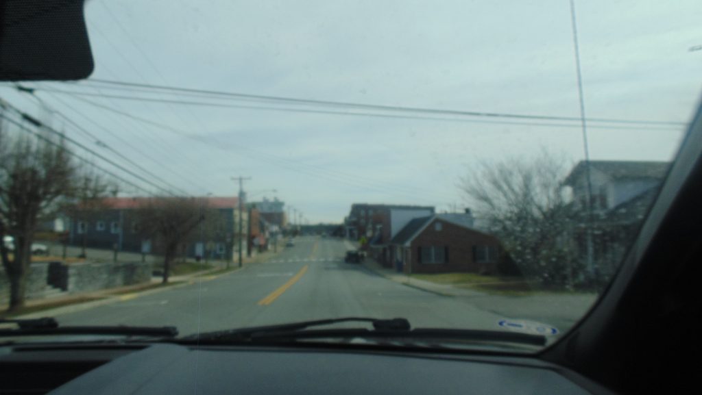
Main street in Hillsville, VA is surrounded by buildings such as the local public library, the Carroll News office, the county courthouse, and a number of restaurants of small boutiques that greet visitors as they drive into the town. In fact, the whole town is fairly small in size and peppered with houses, churches, local businesses, and a few other buildings.
The physical setting of the 1992 challenge of Edgerton’s The Floatplane Notebooks, the town of Hillsville is located in Carroll County, a small, Appalachian community located at the bottom, southwest half of Virginia.1
The Carroll County Office of Tourism records that the area has a population of “29,000 over 478 miles,”2 which attests to size of the region.
Figure 2: Google Map of Hillsville, VA (Google Maps, 2019). Interact with the google map above to explore the site of the Carroll County case.
Economically, The Appalachian Regional Commission (ARC) classifies the county as having a “transitional” economic status, meaning that it has more economic resources and development than many of the counties that lie further west in Virginia, those of which are categorized as being in “distressed” or “at-risk” economic regions.3
Likewise, looking at educational statistics for the area, the ARC also states that from 2012-2016, 79.7% of the area’s population held at least a high school diploma and 12.2% held at least a bachelor’s degree.4 These statistics are slightly lower than ARC data on education levels for the Appalachian region as a whole, where from 2012-2016, the ARC reported that 85.9% of people in the region held at least a high school diploma and 23.2% held bachelor’s degrees.5
Lastly, to speak to the dominant political affiliations of the area, Homefacts reported that in the 2012 presidential election, 67.8% of people in the area voted Republican, 28.4% voted Democrat, and 3.8% voted Independent.6 The election results point to the idea that area has a predominately conservative political outlook.
All of these factors help to set the scene of the challenge and provide statistical foundations for cultural and socioeconomic trends in the area, which influence the lives and perspectives of people within the area.
Citations
- Google Maps. Google Map of Hillsville, VA. 2019. Accessed April 7, 2019. https://www.google.com/maps/place/Hillsville, VA 24343/@36.7623521,-80.7629022,13z/data=!3m1!4b1!4m5!3m4!1s0x885204d6b92d8165:0xfe7ede9c8e275e25!8m2!3d36.7626282!4d-80.7347947
- Carroll County Office of Tourism. Pick.Play.Stay: Carroll County Tourism. Carroll County Office of Toursim. n.d. Accessed April 7, 2019. https://pickplaystay.com/
- The Appalachian Regional Commission. County Economic Status in Appalachia, FY 2019. The Appalachian Regional Commission. August 2018. Accessed April 26, 2019. https://www.arc.gov/research/MapsofAppalachia.asp?MAP_ID=148
- The Appalachian Regional Commission. Socioeconomic Data: Carroll (+ Galax city) County, Virginia. The Appalachian Regional Commission. n.d. Accessed April 7, 2019. https://www.arc.gov/reports/socio_report.asp
- (The Appalachian Regional Commission, n.d.)
- Homefacts. Carroll County, VA Politics and Election Data. Homefacts. 2019. Accessed April 7, 2019. https://www.homefacts.com/politics/Virginia/Carroll-County.html
Photo and Media Credits
Figure 1: Turner, T. Street in Hillsville, VA. 2019. Hillsville, VA.
Figure 2: Google Maps. Google Map of Hillsville, VA. 2019. Accessed April 7, 2019. https://www.google.com/maps/place/Hillsville, VA 24343/@36.7623521,-80.7629022,13z/data=!3m1!4b1!4m5!3m4!1s0x885204d6b92d8165:0xfe7ede9c8e275e25!8m2!3d36.7626282!4d-80.7347947
No Comments Yet